Both the Bainbridge and Kingston routes use State Route 104, which crosses the Hood Canal Bridge. That bridge closes from time to time to let boats pass, so build a little slack into your schedule.
Drive around by road
Skipping the ferry? Head south on I-5 to Olympia and pick up Highway 101 there. You can also drive from Tacoma on State Route 16 to Bremerton, then go north on State Route 3 to State Route 104 and the same Hood Canal Bridge. If you are arriving from the Washington or Oregon coast, join 101 at Aberdeen.
Go without a car
Public transit can carry you to the park's northern side. Catch the Clallam Transit bus from the Bainbridge Island ferry terminal to Port Angeles, then use its routes serving Port Angeles, Sequim, Forks and popular park stops along northern Highway 101. The Dungeness Bus Line links Seattle-Tacoma International Airport with Kingston, Edmonds, Discovery Bay, Sequim and Port Angeles.
In summer, ride the Clallam Transit shuttle from downtown Port Angeles up to Hurricane Ridge, which operates from May until September 1. Recent schedules have the first bus leaving town at 8 a.m. and the last one leaving the ridge at 5:30 p.m., though times can change. Check the park's directions and transportation page for current details and links before you go.
Choosing Your Home Base
With no roads through the interior, drive times between regions add up quickly. The National Park Service publishes a mileage chart, and it is worth a look before you promise yourself the coast and the mountains on the same day.
- Port Angeles or Lake Crescent sets you up well for Hurricane Ridge and the waterfalls and hot springs around Sol Duc.
- The Forks area puts you closer to the Hoh Rain Forest and the tide pools along the coast.
You can stay inside the park, where lodging runs mostly seasonally and one lodge stays open year round. Campgrounds at Hoh, Kalaloch, Fairholme, Mora, Sol Duc and Staircase take reservations, as do popular wilderness camping areas. All other campsites are first come, first served, and the towns outside the park offer more places to rest your head. Book ahead whenever you can.
Exploring the Park Region by Region
Coast, temperate rainforest, glaciated peaks and the drier forests of the east side all come together here. The Park Service suggests sampling each major ecosystem if your time allows, and each one rewards the drive in its own way.
The wild Pacific coast
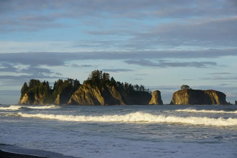
The coastal section is a separate strip about 60 miles long and only a few miles wide. Walk sandy beaches in some spots and scramble past heavy rock and boulders in others, all framed by huge drifts of timber, much of it carried down the Hoh River. Come for the offshore sea stacks, poke into tide pools, or settle in for some storm watching.
Two Native communities live at river mouths along this coast: the Hoh people at the Hoh River and the Quileute at La Push. Near La Push, follow a short trail of about 0.7 miles to Second Beach for views of sea stacks and wildlife. Farther north, the 9-mile Ozette Loop is the most popular stretch of the coast, pairing boardwalk through old cedar swamp with a stretch of beach walking. The Park Service manages use there through a registration and reservation program.
This shore is harder going than it looks. Tides, slick footing, thick brush and wet weather all slow you down, and some headlands can be passed only on overland trails at high tide. Carry a tide table and give yourself extra time.
The rainforest valleys
On the west side, step into the Hoh and Quinault rainforests, where yearly precipitation tops 12 feet and may make them the wettest spot in the continental United States. Unlike tropical rainforests, these are conifer forests of Sitka spruce, western hemlock, Douglas fir and western redcedar, all draped in moss.
Start at the Hoh, with its visitor center and long, level trail, and keep an eye out for the Roosevelt elk herds that roam the valley. Its river valley has been called the quietest place in the country. Near Kalaloch on the western edge, visit the Kalaloch Big Cedar, believed to be Washington's oldest tree at more than 1,000 years. Half of it fell in a 2014 storm, but the rest still stands for visitors to see.
Hurricane Ridge and the high country
Mount Olympus rises to 7,965 feet over the western Olympics and carries the range's largest glaciers, though the park's glacier count fell from 266 in 1982 to 184 by 2009 as the climate warmed. Over on the east side, a rain shadow leaves the landscape drier and craggier, with Mount Deception as its highest summit.
Head to Hurricane Ridge for the easiest way into this high country. It lies 17 miles from Port Angeles and about three hours from Seattle, with a visitor center facing a wall of peaks. In winter, take a run on the short rope-tow slopes or set out for backcountry skiing. In summer, stroll past meadows filled with purple lupine and orange Indian paintbrush.
Lake Crescent and Sol Duc
Lake Crescent is deep and wide enough for boating, and it holds a trout found nowhere else. Campgrounds, boat launches and waterfall trails line its shores. Afterward, follow a nearby road to Sol Duc Hot Springs, a classic place to soak after a hike.
When to Go and What to Book
June through September is the busiest stretch of the year. You do not need a reservation to enter the park, but campsites and lodging fill quickly in summer. Road conditions matter most in fall and winter, so check current status before you set out.
Fees, hours and permit rules can change. Visit the National Park Service planning page for Olympic for current information, trip ideas sorted by how much time you have, and accessibility details.
Why This Park Matters
The story began in 1909, when Theodore Roosevelt first protected the area as Mount Olympus National Monument. Congress and Franklin D. Roosevelt made it a national park in 1938, and it went on to become an International Biosphere Reserve in 1976 and a World Heritage Site in 1981.
About 95 percent of the park is designated wilderness, now called the Daniel J. Evans Wilderness, the largest in Washington. That isolation produced species found only here, including the Olympic marmot. More than 3.7 million people visited in 2024.
Back in the city after your trip? Browse our guide to things to do in Seattle or wander Seattle's own parks for green space closer to home.